AeMobileMapping
13 of October of 2021
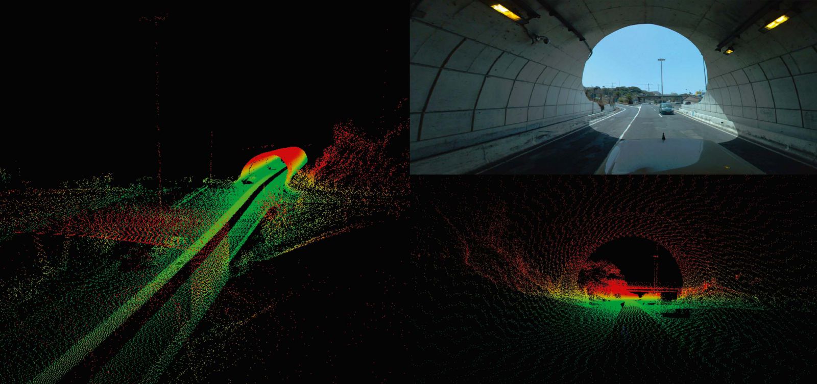
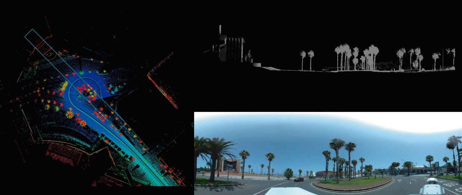
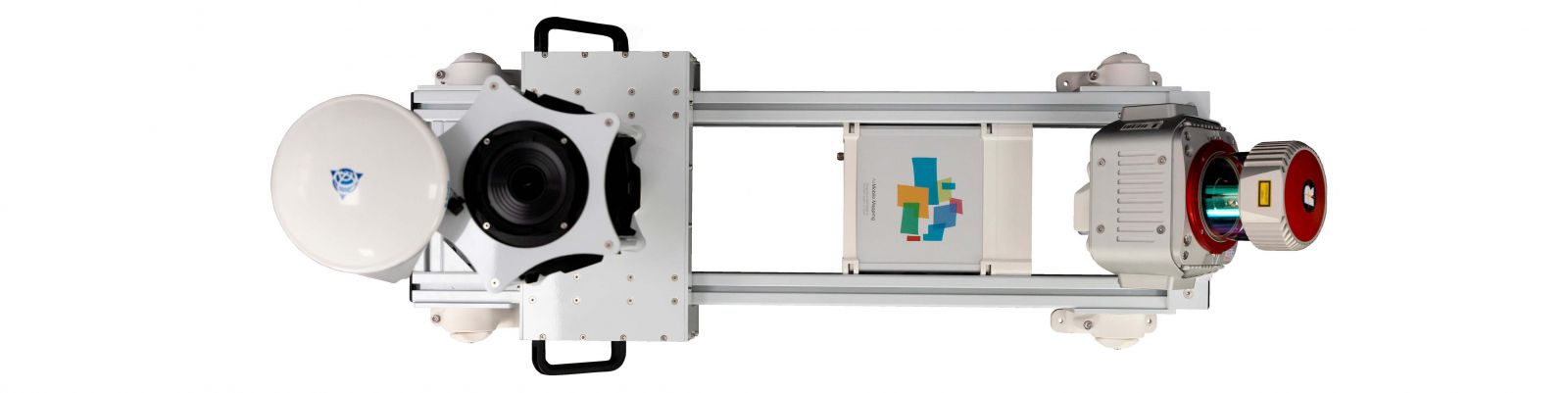
AeMobileMapping is a solution for ground mobile projects that uses LiDAR technology and 3D photography.
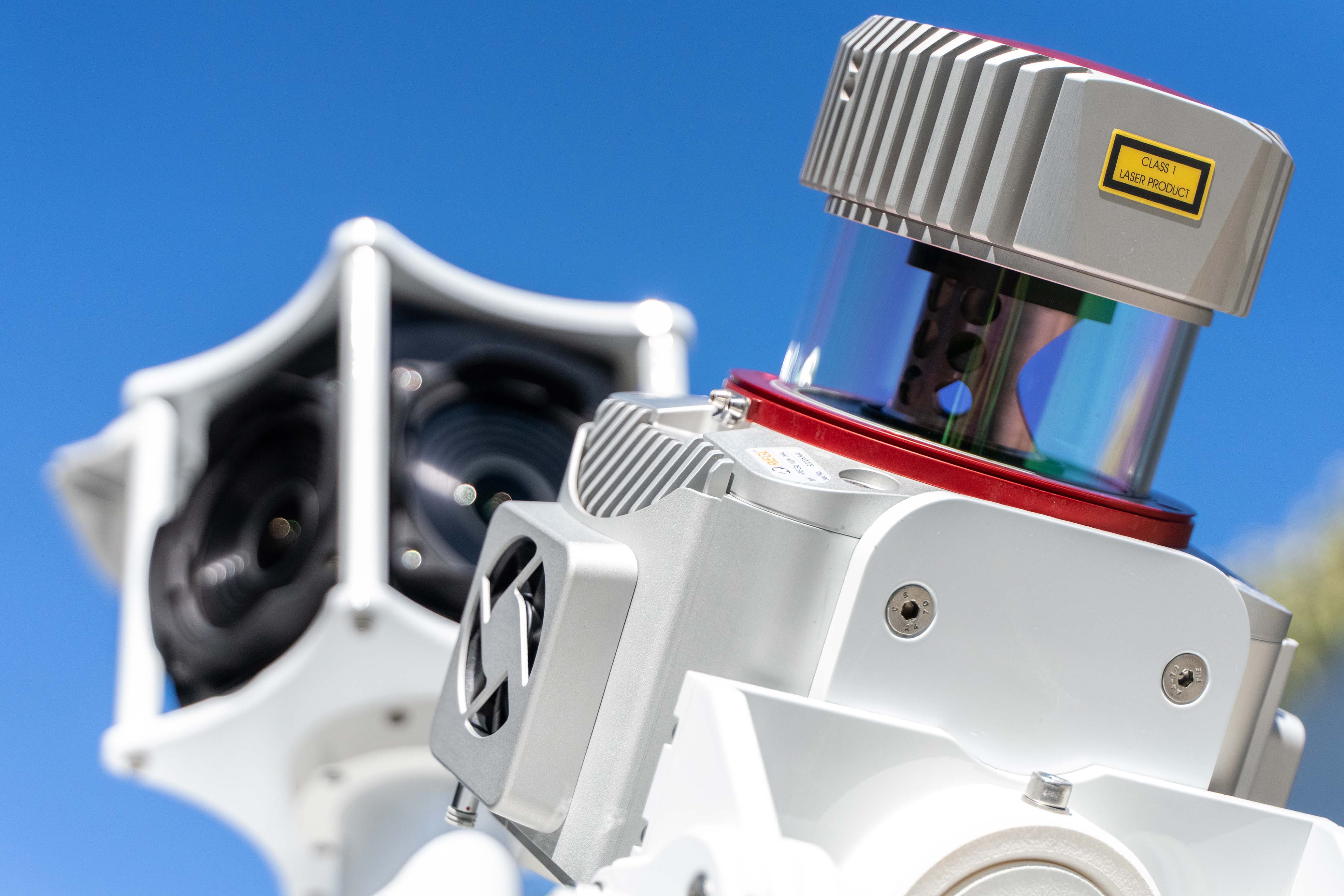
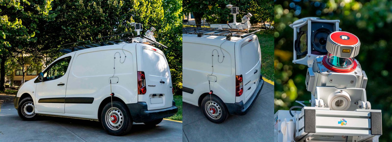
This system uses the Riegl VUX-1HA laser scanner and the Ladybug 5+ camera for 3D photography.
The scanner has 5 different yaw and pitch positions to attend to any type of terrestrial mapping, and 3 camera fixation positions in order to adapt it to any vehicle and project.
The odometer provides one more input for measurements with poor quality GPS navigation during data collection.
The system provides a solution to projects to generate inventory of vertical elements, signage, structures, 360º images, virtual tours, 3D scenarios, road and rail maps, tunnel profile measurement ...
More information AeMobileMapping