Applications of bathymetry: mapping the ocean floor
Every year on 21 June, the International Hydrographic Organisation (IHO) celebrates International Hydrography Day to highlight the vital role of this discipline.
Bathymetry is the most reliable source of information for understanding the marine environment. Mapping the seafloor is fundamental to navigation and coastal environmental management, and allows us to understand the behaviour of the ocean in terms of deep water circulation, tides, tsunami prevention, cold water upwelling, wave dynamics, slope stability or debris management, to name but a few.
The complete analysis of the bathymetry not only provides information on the depth and position of the measured points, but also very relevant data on the geological and geomorphological structure of the seabed.
Among the most common uses of bathymetry, it is used to carry out surveys to ensure navigation, either under or on the surface of the marine environment. It can also be used to study factors that may affect the feasibility of projects or the safety or stability of beaches and jetties. In this sense, the data extracted and analysed serve as a basis for nautical charts to ensure navigability in cases of low or no visibility.
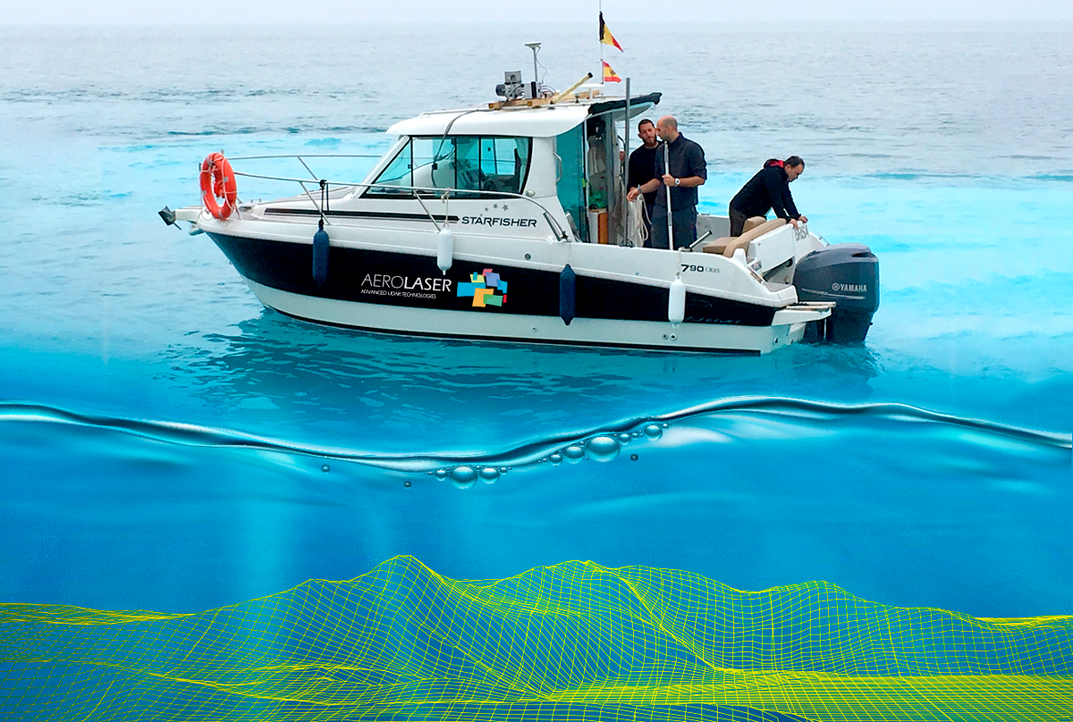
At Aerolaser we use a multi-beam echosounder system, which allows us to collect a range of information from the sound waves emitted to measure the distance between the water surface and the seabed. This allows for greater accuracy and speed of data collection. Using AeBat, our proprietary technology, we carry out simultaneous multibeam bathymetry and mobile mapping to provide continuity between the seabed and the immediate structures or elements above sea level.
Knowledge of our seabed will allow us to create more sustainable scenarios and manage the marine environment effectively by understanding marine habitats, even in deep waters.
It also allows us to create fictitious scenarios of possible natural disasters, such as tsunamis, to predict how the water will move and the impact it could have on the coast in terms of trajectory and intensity.
Bathymetry also allows us to understand the environmental changes of greatest concern in the 21st century. Climate change and global warning, particularly of the oceans, are phenomena that we need to focus on in order to make progress in the difficult task of predicting sea level rise.